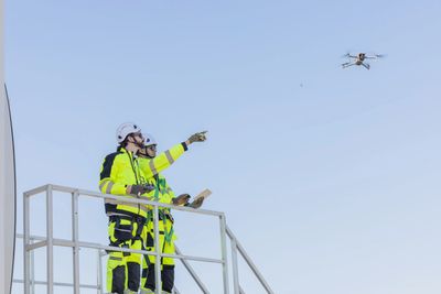
The program enhances your response readiness by enabling rapid aerial assessments, while streamlining data collection and integration into your existing systems.
It also supports training and retaining local talent with modern drone operation skills.
Additionally, co-ops can lever-age shared pilots and equipment through the regional collaboration network to maximize resources and reduce overhead.
By integrating drone technology through AMP4NC, cooperatives can proactively monitor infrastructure, detect potential issues before they escalate, and maintain a stronger, more resilient grid. This forward-looking approach not only reduces downtime but also supports long-term operational efficiency and cost savings.
Showcase your property like never before with our professional drone videography services. We'll capture stunning aerial footage that will give potential buyers a unique and immersive view of your property.
Capture the excitement of your event from a whole new angle with our drone photography and videography services. Our skilled pilots will get the perfect shot, no matter the event.
AMP4NC helps co-ops work smarter and faster by improving inspections, training staff, and sharing resources to save time and reduce costs.
AMP4NC streamlines inspection workflows, enabling your field teams to complete tasks faster and with less effort, freeing up resources for other
By using drones, routine inspections require less time and fewer personnel, resulting in significant savings on labor and travel expenses.
Drones provide rapid aerial assessments after storms, helping co-ops quickly identify damage and prioritize restoration efforts.
The program supports seamless integration of aerial data into your existing asset management and GIS systems, improving decision-making.
AMP4NC offers comprehensive training that empowers local staff with modern drone skills, increasing workforce capability and retention.
Through regional collaboration, co-ops can access contract pilots and shared equipment, reducing individual investment costs and improving scalability.
Copyright © 2025 Aerial Monitoring Program for North Carolina - All Rights Reserved.
We use cookies to analyze website traffic and optimize your website experience. By accepting our use of cookies, your data will be aggregated with all other user data.